|
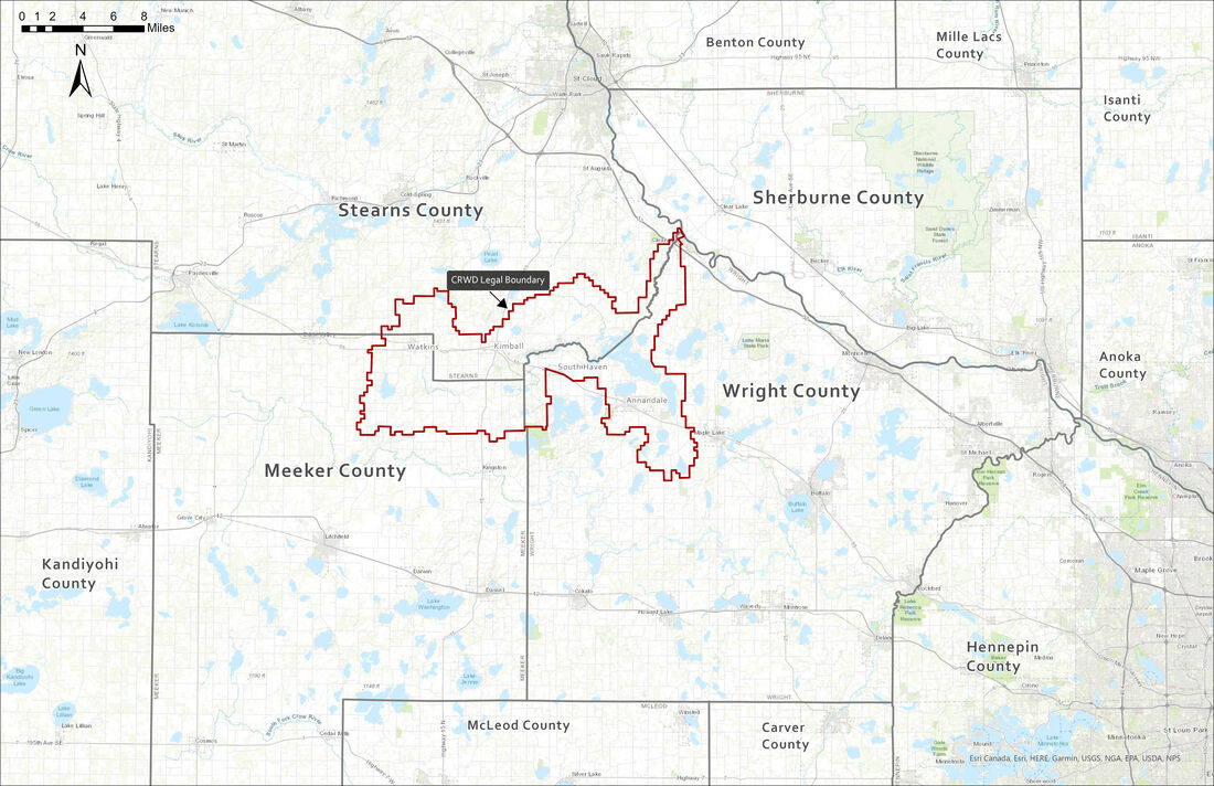
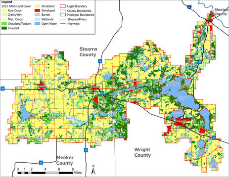
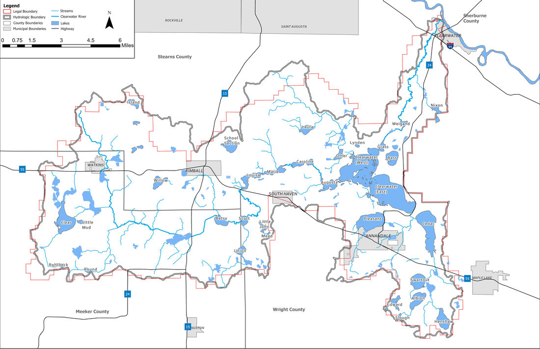
The Clearwater River Watershed District (CRWD) encompasses the entire drainage area of the Clearwater River. It is 158.8 square miles, with 46.1 square miles in Meeker County, 54.2 square miles in Stearns County, and 58.5 square miles in Wright County. The District extends approximately 22.5 miles from east to west and 16.5 miles from north to south. Municipalities included (all or part) within the District are Annandale, Clearwater, Kimball, South Haven, and Watkins, as well as the Village of Fairhaven. Townships located totally or in part within the CRWD are: Albion, Clearwater, Corinna, Fair Haven, Forest City, Forest Prairie, French Lake, Kingston, Luxemburg, Lynden , Maine Prairie and Southside.
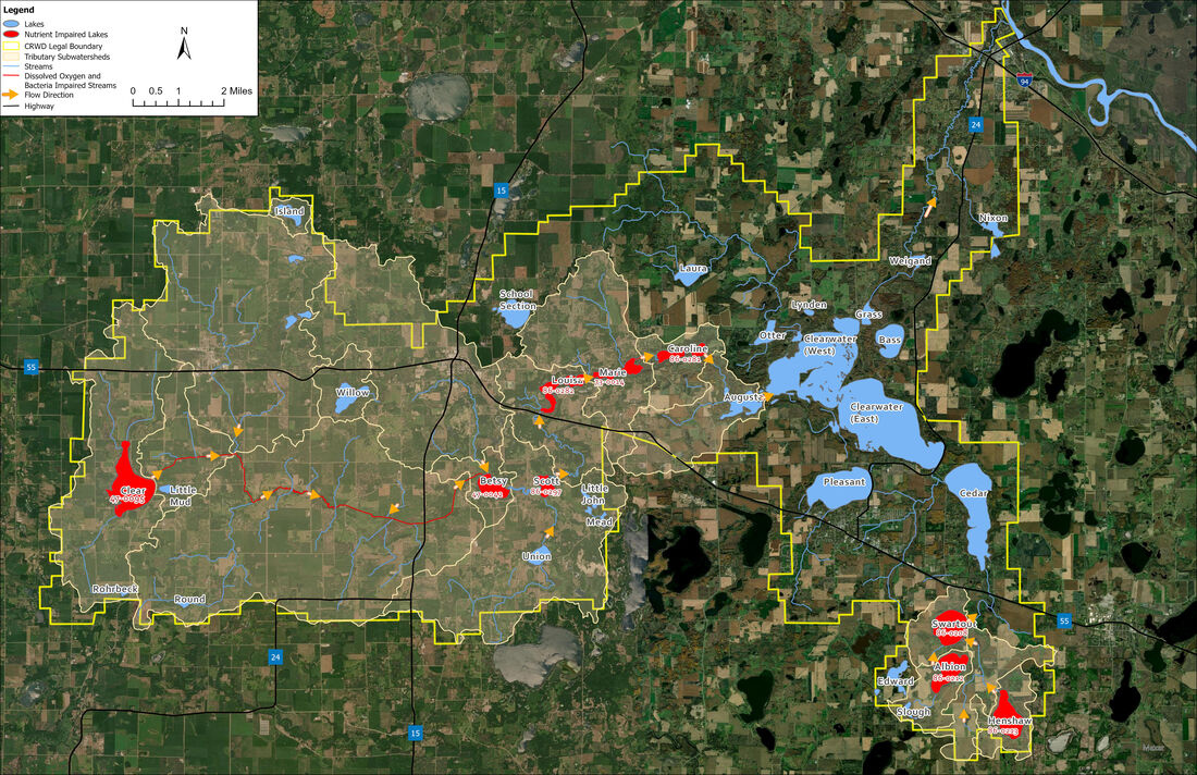
The lakes through which the Clearwater River flows are divided into an Upper and Lower Chain by the Fairhaven dam. The Upper Chain includes Lakes Betsy, Scott, Louisa, and Marie (which includes the Mill Pond). The Lower Chain includes Lakes Caroline, Augusta, Clearwater, Grass, and Wiegand. Other major lakes in the District are: Albion Lake, Bass Lake, Cedar Lake, Clear Lake, Henshaw Lake, Little Mud Lake, Nixon Lake, Otter Lake, Pleasant Lake, School Section Lake, Swartout Lake, Union Lake, Willow Lake. Non-major lakes are: Edwards Lake, Island Lake, Laura Lake, Rohrbeck Lake and Round Lake. The Clearwater River begins southwest of Watkins and is joined by a tributary known as County Ditch 20 as it meanders south, than east as it enters the Upper Chain. It flows north under State Highway 55 between Kimball and South Haven, then generally east through the Lower Chain until it outlet from Clearwater Lake, where is flows northeast through Grass and Wiegand Lakes, and discharges into the Mississippi River at the City of Clearwater. There are three dams along the river: the Fairhaven Mill Dam at the outlet of Lake Marie (south of the the City of Fairhaven); the Grass Lake Dam at the outlet of Grass Lake, and the Clearwater Dam on Stearns County Road 75 (in the City of Clearwater). Click here to see a list of CRWD Lakes within each County and their acreage. For more information, be sure to check out our Water Management Plan. For information on the quality of water in the district, check out our Water Quality Monitoring page. For information on the District's projects, check out our Projects page. Listed below are some maps of the District. More can be found in our Water Management Plan. |
- About
-
Projects
- Carp Management 2023-2024
-
Clearwater River Chain of Lakes (1980) Restoration Project
>
- Annandale Wetland Treatment System
- Kingston Wetland Feasibility Study and Restoration Project
- Lake Augusta Aeration Project
- Lake Augusta Erosion Control Project
- 1980 Monitoring Program
- Non-Point Source Pollution Abatement (TCCP) Project
- Upper Lakes Aeration and Mechanical Fish Removal
- Watkins Wetland Isolation Project
- Watkins Wetland Treatment System
- Replacement Projects for Aerators
-
Total Maximum Daily Load (TMDL) Implementation Projects
>
- Alternative Tile Intake Project
- Clearwater River Channel Stabilization (CCM Riparian) Project
- Clearwater River Restoration & Protection Phase II Project
- City of Kimball Stormwater Treatment Phase II
- Targeted Fertilizer Application Reduction Project
- Watkins Area Stormwater Treatment Project
- Willow Creek (Kimball Phase I) Stormwater Retention / Reuse Project
- Potential Future Implementation Projects
- Bass Lake AIS Management
- Clear Lake North V-Notch Weir
- Clear Lake South Notch Weir
- Clear Lake IESF
- Cedar Albion Swartout Henshaw Project #06-1 >
- Clearwater Lake Milfoil Treatment
- CRWD Bog Control Projects
- Communal Sanitary Sewer Systems >
- Lake Augusta Aquatic Invasive Species (AIS) Project
- Lakes Louisa & Marie Aquatic Invasive Species (AIS) Project
- Norton Avenue Basin
- Ostmark Basin
- Pleasant Lake Outlet Control Structure
- Cedar Lake Aquatic Invasive Species (AIS) Project
- School Section Lake Outlet Control Structure
- Wastewater Treatment Task Force
- Programs
- Resource Library
- How You Can Help
- Contact
|
This page is maintained by CRWD Board Managers.
© Copyright 2020 |
Board Meetings
Third Wednesday of the month at 6pm Special and emergency meetings may be called. Such meetings will be properly notice per MN Statutes. |
Clearwater River Watershed District
93 Oak Avenue South, Suite 5 Annandale, MN 55302 Mailing Address:
3235 Fernbrook Ln N Minneapolis, MN 55447 |
Website created by Skol Marketing


